Istanbul
Istanbul for property buyers: the main areas and how they differ
Published: Written by: ALTEX Realty team
Not sure where to start?
Tell us why you are buying, your budget and timing. See three Istanbul districts to consider, matching projects and what to check first.
Where to startShort answer: Istanbul is split by the Bosphorus into a European side and an Asian side, and each side has its own airport, business areas and seafront. Most buyers should look at three things first: which rail line is close to the home, whether the project is finished, and which districts have homes in their budget. The sections below explain the main areas in plain terms.
As of October 2026. General information, not investment advice.
Why buy a home in Istanbul: life in the city at a glance
This section is about everyday life in Istanbul, not about returns. We do not forecast prices or rents.
Life between two continents
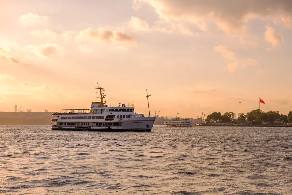
Istanbul lies on both sides of the Bosphorus, so one city is in Europe and in Asia at the same time. People cross the water every day by ferry, by the Marmaray rail tunnel or over the bridges. Şehir Hatları, the city’s ferry company, has piers on both sides, including Kadıköy, Üsküdar, Eminönü and Karaköy.
It is a very large city. TÜİK, the national statistics office, counted 15,754,053 residents in Istanbul at the end of 2025, 18.3% of Türkiye’s population. Daily life still happens at neighbourhood level: many neighbourhoods have a weekly street market (pazar), bakeries, tea houses and a local mosque within walking distance.
Culture and history
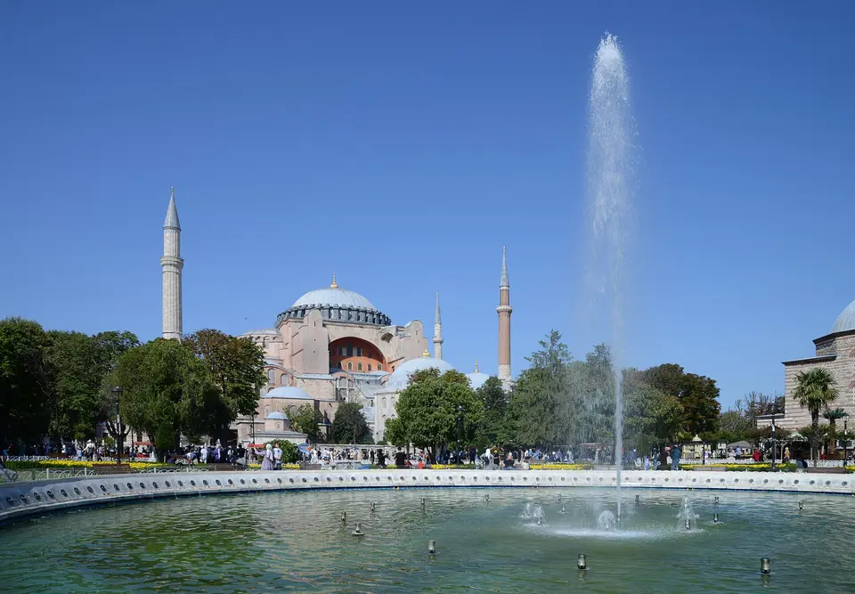
Istanbul was the capital of the Eastern Roman Empire and then of the Ottoman Empire. UNESCO has listed the “Historic Areas of Istanbul” as a World Heritage site since 1985. The listing covers four areas: the archaeological park at the tip of the historic peninsula, with Hagia Sophia and Topkapı Palace; the Süleymaniye quarter; the Zeyrek quarter; and the land walls. The T1 tram runs through the historic peninsula, so for residents these places are part of the city, not a one-off trip.
Getting around without a car
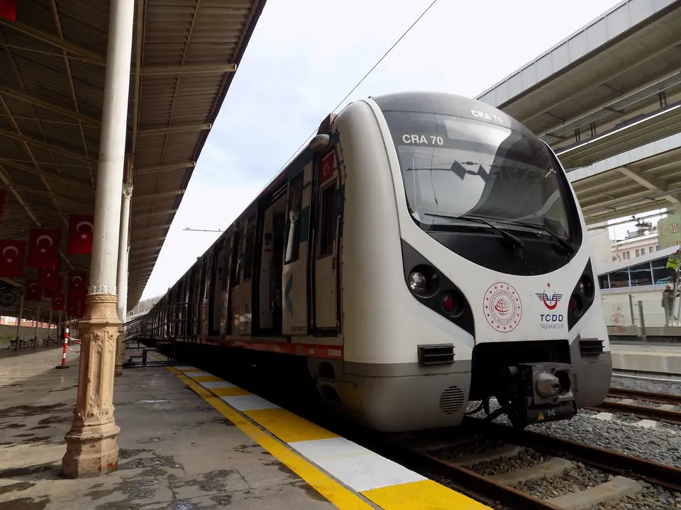
Much of Istanbul can be reached by rail. Metro Istanbul runs 18 metro, tram, funicular and cable-car lines. Marmaray and the M11 airport line are run by TCDD Taşımacılık, and the Metrobüs rapid bus has its own lane across the Bosphorus Bridge. Not every district has a station, so check the walk from the exact address to the nearest stop. The full list of lines in operation, and the districts they serve, is in “The transport backbone” section on this page.
Airports and links to the world
Istanbul has two international airports, one on each side. According to DHMİ, the state airports authority, Istanbul Airport on the European side handled about 84.5 million passengers in 2025, and Sabiha Gökçen Airport in Pendik, on the Asian side, about 48.4 million. The M11 line runs to Istanbul Airport and the M4 line to Sabiha Gökçen. If you will fly often, check the trip from the home to the airport you use most before you choose an area.
Universities, schools and hospitals
The Council of Higher Education (YÖK) lists 12 state universities and 44 foundation (non-profit private) universities in Istanbul. Public hospitals are run by the Ministry of Health; Başakşehir Çam and Sakura City Hospital, for example, opened in 2020 and has its own stop, Şehir Hastanesi, on the M3 metro. There are also university and private hospitals. For children, ask your advisor which state, private and international schools are near the exact address, and check the nearest hospital on the same visit.
Climate and seasons
Istanbul has four seasons. In the Turkish State Meteorological Service’s long-term figures (1950–2025), January averages 6.8 °C, with an average high of 9.6 °C. July and August both average 24.7 °C, with an average high of 29.7 °C. Most rain falls between October and March: December is the wettest month, at 99.2 mm on average, and July the driest, at 22.1 mm. When you view a home, ask about heating, insulation and shade on the balcony.
Buying as a foreigner: how it works
Foreigners can buy a home in Istanbul in their own name, within limits set by Turkish law, and do not need a residence permit to buy. The usual order is: choose the exact unit, get a Turkish tax number, check the title deed, sign the contract in the form the law requires, get a valuation report, pay through a bank and sign the deed at the Land Registry office. Our guide How to buy an apartment in Istanbul as a foreigner explains each step.
Buying a home does not by itself make you a Turkish citizen. Citizenship has its own conditions and an official process; read how citizenship by property works. If you are not sure where to start, the “Where to start” questions suggest districts and projects for your purpose.
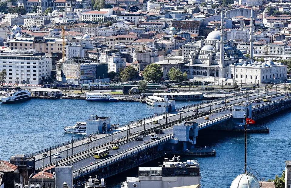
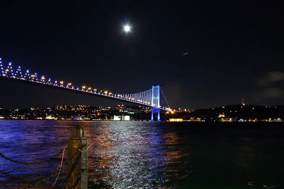
Two sides of one city
The Bosphorus strait runs through Istanbul from the Black Sea to the Sea of Marmara. The European side lies to the west of it and the Asian side to the east. You can cross by road bridges, by the Marmaray rail tunnel under the strait, or by ferry.
| European side | Asian side | |
|---|---|---|
| Airport | Istanbul Airport, in the north, reached by the M11 line | Sabiha Gökçen Airport, in Pendik, at the end of the M4 line |
| Main business areas | Levent, Maslak and Mecidiyeköy, along the M2 metro | The Ataşehir finance centre area and Ümraniye |
| Seafront | The Bosphorus shore and the Marmara coast to the west, out to Beylikdüzü and Büyükçekmece | The Bosphorus shore at Üsküdar and Beykoz, and the Marmara coast from Kadıköy through Maltepe, Kartal and Pendik |
| Rapid bus | The Metrobüs starts in Beylikdüzü and crosses the Bosphorus to the Asian side | The Metrobüs ends at Söğütlüçeşme in Kadıköy |
Neither side is “better”. The right side for you depends on where you will work, which airport you use most, and whether you want the city centre or a quieter setting.
The transport backbone
When you compare projects, the most useful single question is: which rail line is near the home, and how far is the walk? Istanbul’s lines are run by different operators, so check the operator’s own map before you decide.
- Marmaray is the suburban rail line along the Marmara coast, from Halkalı on the European side to Gebze, east of the city. It crosses under the Bosphorus and links the two sides, with stations in districts such as Üsküdar, Maltepe, Kartal and Pendik.
- M1A runs west from Yenikapı through Zeytinburnu and Bakırköy to the Atatürk Airport stop. M1B shares its track as far as the bus terminal (Otogar) and then runs to Kirazlı in Bağcılar.
- M2 runs north from Yenikapı through Taksim, Şişli, Levent and Maslak to Hacıosman.
- M3 runs from Bakırköy on the coast north to Kayaşehir in Başakşehir, with a stop at the city hospital.
- M4 runs along the Asian side from Kadıköy through Maltepe, Kartal and Pendik to Sabiha Gökçen Airport.
- M5 runs from Üsküdar east through Ümraniye and Çekmeköy to Sultanbeyli.
- M6 is a short branch from Levent to Boğaziçi University at Hisarüstü.
- M7 runs from Yıldız in Beşiktaş through Mecidiyeköy and Kağıthane to Mahmutbey.
- M8 runs from Bostancı on the Asian coast north through Ataşehir to Dudullu and Parseller.
- M9 runs from Ataköy on the coast north to Olimpiyat in Başakşehir.
- M11 runs from Gayrettepe and Kağıthane to Istanbul Airport, and continues west to Kayaşehir in Başakşehir and to Halkalı, where it meets Marmaray.
- Trams: T1 runs from Kabataş through the historic peninsula to Bağcılar; T4 from Topkapı north to Mescid-i Selam; T5 along the Golden Horn from Eminönü to Alibeyköy; T3 is a short loop in Kadıköy and Moda.
- Short links: the F1 funicular (Taksim–Kabataş), the F4 funicular (Hisarüstü–Aşiyan), the historic Tünel (Karaköy–Beyoğlu) and two cable cars (Maçka–Taşkışla and Eyüp–Piyer Loti).
- The Metrobüs is a rapid bus line on its own lane, from Beylikdüzü in the west across the Bosphorus Bridge to Söğütlüçeşme on the Asian side.
This list covers the lines in operation in October 2026. More lines and extensions are under construction; we add them here only once they open.
Some districts have no metro or Marmaray station, for example Beylikdüzü, Büyükçekmece and Beykoz. That can be fine for a holiday home or a villa, but plan on a car or a bus for daily trips.
District groups
These groups only describe the type of area. They are not rankings, and every district has very different streets inside it.
City centre and business districts. Şişli, Beşiktaş and Kağıthane on the European side sit around the Levent, Maslak and Mecidiyeköy business areas. Ataşehir and Ümraniye play a similar role on the Asian side. These districts have the most rail lines. Homes here are often in high-rise or mixed-use buildings, and new-build choice is smaller than in the outer districts.
Newer planned districts. Başakşehir on the European side has large planned residential areas, parks and wide roads, the M3 metro and the M11 airport line. Many of the projects on our site are here. It is far from the historic centre.
The seafront. On the Asian side, Maltepe, Kartal and Pendik follow the Marmara coast and share Marmaray and the M4 metro. On the European side, Beylikdüzü and Büyükçekmece face the Marmara Sea to the west and rely on roads and the Metrobüs. A district on the coast does not mean every project has a sea view; that depends on the project, the block and the floor.
Bosphorus and green districts. Üsküdar, Beykoz and Sarıyer sit on the Bosphorus. Üsküdar is an established district with Marmaray, the M5 metro and ferries. Beykoz and northern Sarıyer are greener, with forests, villages and villa projects, and you will usually need a car.
District guides are linked from each group when they are published.
When each area makes sense
Instead of asking where it is “best” to buy, start with what you need the home for.
- To live in it: start from your daily trips. If you will work in Levent or Maslak, look along the M2 and M7 lines. If you will work on the Asian side, look along the M4, M5 and M8 lines. Then check schools, hospitals and shops near the exact address with your advisor.
- For rental income: think about who your tenant will be. Smaller units near rail lines and business areas and larger units in family areas suit different tenants. We do not publish rental-return figures. If you are thinking about short stays, read the note below first.
- With citizenship in mind: the rules depend on the value of the property and the official process, not on the district. Read how citizenship by property works before you choose an area.
- For the long term or as a holiday home: decide whether you want a finished home or are happy to wait for an off-plan project, and whether you want the sea, nature or the city. We do not forecast prices.
The “Where to start” questions on our site turn these choices into three districts and matching projects.
Things to check
- Listed delivery dates can pass before a project is finished. On our site, many projects still show “under construction” after their listed date. Ask which units are ready to move in.
- Prices on our site are listed asking prices. They change, and an advisor confirms the current price and availability.
- Not every location is open to foreign buyers. Turkish law limits how much land in a district foreign individuals can own and allows purchases only by citizens of countries set by the President; military and security zones are handled under separate rules. The land registry checks this for each property. Ask a lawyer if a property is near a military area.
- Short-stay (holiday) rentals need a permit. A permit from the Ministry of Culture and Tourism is needed before renting a home to guests for short stays, and the application needs a unanimous decision of all owners in the building. Long-term rentals are outside this law.
- Running costs differ by building. Ask about the building’s management fees and what they cover before you buy.
Photo credits
- “Istanbul ferry at sunset on the Bosphorus”, by Tarikkaanmuslu, CC BY-SA 4.0, via Wikimedia Commons.
- “Hagia Sophia Istanbul July 2022”, by Alvesgaspar, CC BY-SA 4.0, via Wikimedia Commons.
- “Marmaray TCDD E32000 at Sirkeci”, by Zach1055, CC BY-SA 4.0, via Wikimedia Commons.
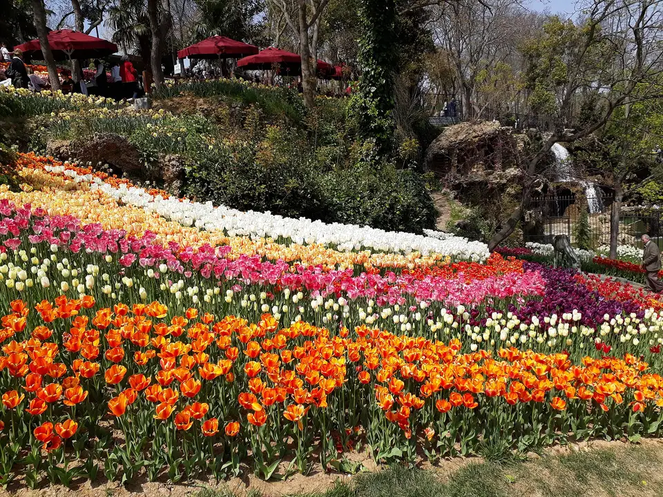
- “Tulip Festival Emirgan 2018”, by Husain007, CC BY-SA 4.0, via Wikimedia Commons.
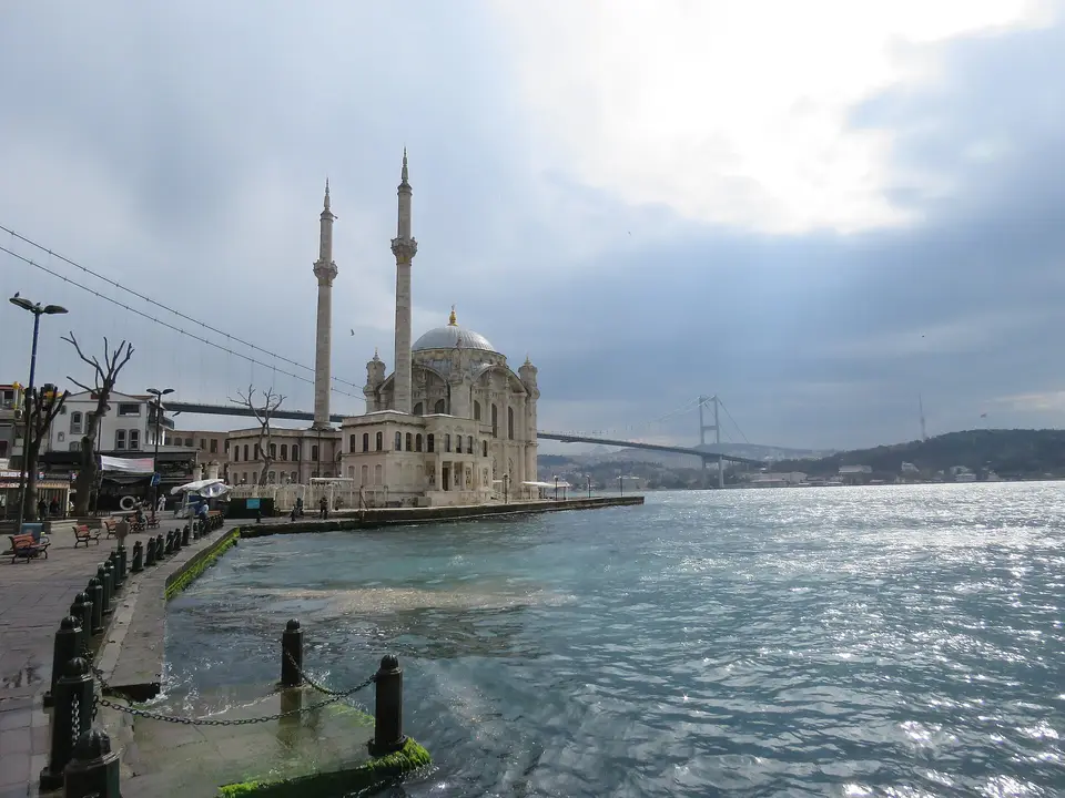
- “Ortaköy Mosque and Bosphorus Bridge, March 2024”, by Calistemon, CC BY-SA 4.0, via Wikimedia Commons.
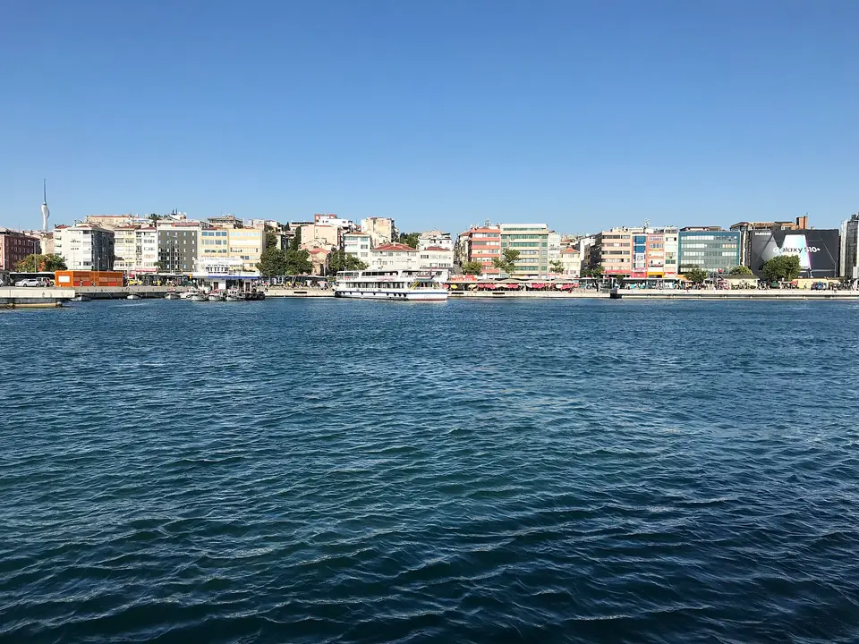
- “Kadıköy Coast 20190727”, by Sakhalinio, CC BY-SA 4.0, via Wikimedia Commons.
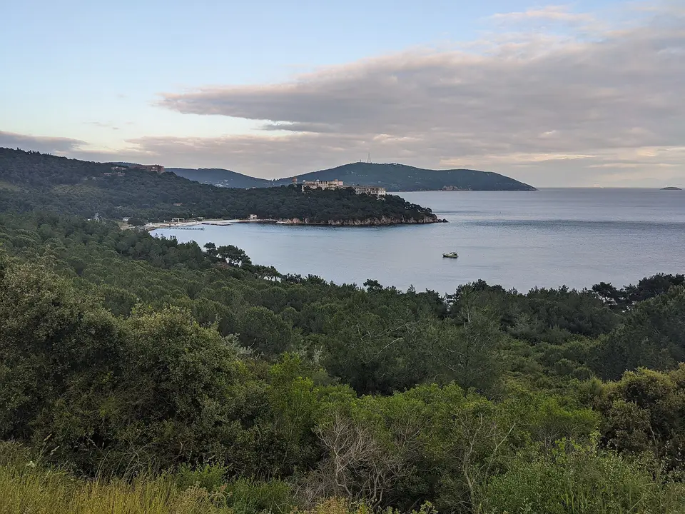
- “View over Çam Limanı Bay and the old sanatorium on Heybeliada”, by Oystercard, CC BY-SA 4.0, via Wikimedia Commons.
- “Galata Bridge viewed from Galata Tower in 2024”, by Julian Lupyan, CC0, via Wikimedia Commons.
- “Ortaköy gece boğaz köprüsü”, by by rock, CC BY 3.0, via Wikimedia Commons.
Resized and converted to WebP.
Frequently asked questions
Which side of Istanbul should I buy on?
It depends on where you will work, which airport you use most and whether you want the city centre, the sea or a quieter area. Both sides have business areas, a seafront and rail lines, so neither side suits every buyer.
Which districts are near Istanbul Airport?
The M11 metro line runs from Gayrettepe to Istanbul Airport, with stations in Kağıthane and in Eyüpsultan, including Göktürk, according to Istanbul Airport. Check the walk from a project to the nearest M11 station.
Which districts are near Sabiha Gökçen Airport?
Sabiha Gökçen Airport is in Pendik. The M4 metro line runs to it from Kadıköy through Maltepe, Kartal and Pendik (Metro Istanbul).
Can foreigners buy property anywhere in Istanbul?
Not everywhere. Under Article 35 of Land Registry Law No. 2644, foreign individuals from countries set by the President can buy within legal limits: foreigners' holdings may not exceed 10% of a district's privately owned area, or 30 hectares per person nationwide. Under Law No. 2565, foreigners cannot buy in certain military zones, and the land registry checks each property before the sale.
How can I tell whether a project is finished?
Each project page shows the status and delivery date as listed. Listed dates can change after they are published, so ask an advisor which units are ready to move in before you visit.
How is Istanbul connected to the rest of the world?
Istanbul has two international airports, one on each side of the Bosphorus. According to DHMİ, Istanbul Airport handled about 84.5 million passengers in 2025 and Sabiha Gökçen Airport about 48.4 million. The M11 metro line runs to Istanbul Airport and the M4 line to Sabiha Gökçen.
General information only — please confirm with your own lawyer before deciding.
Sources
- Metro İstanbul: Our lines (all lines in operation) (accessed )
- Metro İstanbul: M2 Yenikapı–Hacıosman line (accessed )
- Metro İstanbul: M3 Bakırköy–Kayaşehir line (accessed )
- Metro İstanbul: M4 Kadıköy–Sabiha Gökçen Airport line (accessed )
- Metro İstanbul: M5 Üsküdar–Sultanbeyli line (accessed )
- Metro İstanbul: M7 Yıldız–Mahmutbey line (accessed )
- Metro İstanbul: M8 Bostancı–Parseller line (accessed )
- Mevzuat Bilgi Sistemi: Law No. 7464 (short-term rentals of homes for tourism) (accessed )
- Mevzuat Bilgi Sistemi: Land Registry Law No. 2644, Article 35 (accessed )
- Metro İstanbul: M1A Yenikapı–Atatürk Airport line (accessed )
- Metro İstanbul: M1B Yenikapı–Kirazlı line (accessed )
- Metro İstanbul: M6 Levent–Boğaziçi University/Hisarüstü line (accessed )
- Metro İstanbul: M9 Ataköy–Olimpiyat line (accessed )
- TCDD: Marmaray (accessed )
- TCDD Taşımacılık: Marmaray stations (accessed )
- TCDD Taşımacılık: Gayrettepe–Istanbul Airport–Halkalı line timetable (accessed )
- İGA İstanbul Havalimanı: Airport transportation (M11 metro line) (accessed )
- İETT: Metrobüs (accessed )
- İETT: Tünel (Karaköy–Beyoğlu) (accessed )
- Mevzuat Bilgi Sistemi: Law No. 2565 on Military Prohibited Zones and Security Zones, Articles 9 and 28 (accessed )
- İstanbul Sabiha Gökçen International Airport: Transportation (accessed )
- TÜİK (Turkish Statistical Institute): Address Based Population Registration System Results, 2025 (bulletin 53899) (accessed )
- DHMİ (State Airports Authority): Passenger traffic, January–December 2025 (accessed )
- UNESCO World Heritage Centre: Historic Areas of Istanbul (accessed )
- YÖK (Council of Higher Education): State universities (accessed )
- YÖK (Council of Higher Education): Foundation universities (accessed )
- Ministry of Health: Başakşehir Çam and Sakura City Hospital opened (accessed )
- Turkish State Meteorological Service (MGM): Istanbul long-term statistics, 1950–2025 (accessed )
- Şehir Hatları: Istanbul city ferries (accessed )